Netherlands – open source Geozet combines GIS & zoning information
Once more the public sector overseas is showing the way on how to use open source software in its areas of competence.
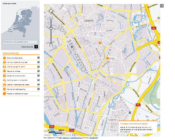
Last week, software combining geographic information systems (GIS) with zoning regulations and other country-wide sources of land use information and offered online as an interactive map, was made available as open source software by the Dutch Interior Ministry. The tool, titled Geozet, has been hosted on the OSOR Forge since 1 November, OSOR reports.

Geozet’s aim is to give citizens easy access to government information; it can be used as a web service on local authority websites. For example, a map can display all building permits and the exemptions of regulations in a local authority, with the map being searchable by postcode.
“Geozet can be used by every possible party to display specific information on a map”, according to a short introduction on the OSOR Forge.
The software is made available using the GPLv3 free software licence. One of the Interior Ministry’s policy advisers stated: “Initially we thought of publishing the code using the EU’s public licence EUPL. But for the development we used Ext JS javascript and that is GPLv3. To keep it simple, we settled on using the same licence. A second reason is that the GPLv3 is a copyleft licence, in line with the Dutch government’s policy on open source.”
The tool was made public last week in a ceremony in the city of Utrecht. According to a report on the site of Geonovum (in Dutch), a non-departmental public body on geographic information standards, the tool is intended to ease the access to information on zoning regulations and land use. “I wanted a map that tells me what I can do where”, it quotes Kees Keuzekamp from the Interior Ministry. “Suppose I want to start a sawmill, where is that allowed and where is it possible? Geozet combines the zoning information with a map.”
In functionality, the tool is similar to software built by the Flemish government in Belgium, the Magda Geo platform – a suite of tools allowing users to combine several kinds of maps with information taken from databases managed by public administrations, whose development started in 2007.
There’s a temporary site available giving a demonstration of Geozet, if you know enough Dutch.
